
Non-Riparian Project
Project Overview
The Arkansas Natural Resources Commission (ANRC) is responsible for permitting the transport of water for non-riparian use in Arkansas. Over the past five years, non-riparian water use for natural gas fracking activities in the Fayetteville Shale Play has resulted in approximately 1600 non-riparian permit actions and a significant amount of data that must be managed and shared. Information and data related to the timing, location, and quantity of permitted non-riparian water use in the Fayetteville Shale Play is of great interest to government agencies, the public, and private sector entities. During our recent ‘boom’ in non-riparian water usage the quantity of this permit data workload/processing dramatically increased. ANRC determined the need to develop a geospatial data system that could improve internal permitting processes, increase the agencies data management capacity, and also provide a web-based interface to better distribute publicly available information. As of 2015, ANRC did not have a way systematic or centralized way to analyze, compile, and then easily share (electronically) any of their non-riparian program information to the public. Best practices were applied within the agency program staff but those practices can break down when workloads reach high levels, such as the recent Arkansas Shale boom.
Project Objective
To develop and evaluate a prototype system to include a functional geospatial web information portal, and database management system specifically within the non-riparian permitting program/division of ARNC. The goal if this project to develop effective strategies and tools which could increase internal efficiencies within the non-riparian permitting processes in order to be better prepared for Arkansas’ next non-riparian water use boom.
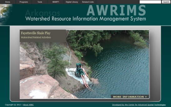
A prototype web content management system has been developed by the Center for Advanced Spatial Technologies (CAST) through ANRC multi-agency efforts unrelated to the non-riparian permitting program (2010-2012). The web based system, was identified as the Arkansas Watershed Resource Information Management System (AWRIMS), as a demonstrably stable and secure geospatial web interface system on which additional analytical and functional tools could be presented within specifically to support and improve the non-riparian permit communication with the public. – Although, with the recent changes to the existing ANRC website, these products may be best served from the agency website too. This is to be determined.
Project Deliverables
New procedures and processing components will be proposed for the non-riparian permitting system and will be developed through iterative decision-support processes, analytical programming and software compatibility in conjunction with ANRC staff expertise. The primary deliverables for this proposed AWRIMS development for the non-riparian permitting program are summarized below.
Enhance the Internal ANRC Permitting workflow(s)
Much of the current analyses completed by ANRC staff during the permitting process are hand or desktop GIS calculations, such as delineation of drainage area and assessment of existing permit quantities and locations. Automation of and standardizing some of these processes and calculations could increase consistency during the permit processing, determination and post-analysis capabilities. A user-friendly interface for use by existing ANRC staff can be developed and integrated within the ANRC non-riparian permitting workflow(s).
Better integration of SQL Data Management Practices
Inclusion of geospatial capacity and analyses into the permitting program will require a more robust data management system (DBMS) that can leverage GIS services efficiently. In order to provide a more streamlined data collection, status reporting and permit evaluation workflow by ANRC staff specialists, an integrated enterprise-level SQL-based geodatabase will be designed to replicate some of the existing Microsoft Access data input and geospatial attribution.
Develop a Non-Riparian Information Portal for Web Access to Water Use Information
An important issue for ANRC is the need for accurate and transparent reporting of non-riparian permitting and water use data. In 2015, there was no automated way to access or provide general information about non-riparian permitting data to entities outside ANRC. The Non-Riparian water use reporting was at least three months behind the actual consumption dates during peak production periods and there was virtually no way to plan, proactively, for any proposed water consumption within the Shale Play watersheds of Arkansas. Therefore, an information portal will be developed which contains intuitive and user-friendly queries for the most commonly requested non-riparian permit data or summary maps to support internal decision-making. Other complimentary and relevant watershed-level data will be included when appropriate to provide insight and meaning to watershed-level water planning.
Geospatial Data Mapping Tools
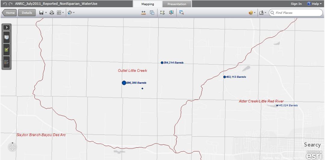
The goal of this non-riparian system was to create powerful yet simplistic web-based mapping and geospatial tools that can operate as desktop applications directly through to web interfaces for public consumption. These extremely powerful web feature services allow the desktop GIS user to perform tasks normally limited to advanced database users by serving as the user-interface to an enterprise DBMS. Specific GIS tasks performed in the non-riparian program include: delineation of drainage areas, digitization of ponds, attachment of mapping attributes to individual database records, and the creation of mapping products for reporting and presentation of permit data. Mapping services will be designed to support and improve standardization of tasks performed in the non-riparian permit program.
Decision Logic & Program use that can be sustained within ANRC
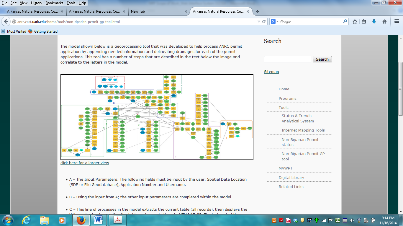
Decision logic and integrated programming should be developed through iterative discussions on which specific tasks could be automated within ANRC. Geoprocessing tools could help automate those permitting GIS tasks that are well-suited for standardization and also compliant with existing ANRC staff and agency software environments. Programming scripts could update web mapping services and geospatial datasets to help track and share non-riparian permit information (internally and externally), while ensuring compatibility with state GIS community. ANRC should be able to establish user-level permission management on these datasets and the resulting map services. Security protocols will be established to ensure secure SSL connections to and from end-users at ANRC offices or remote locations.
Project Report
The new procedures and processing components proposed within this project will be documented and demonstrated within our final report.